The rain has stopped for now and the
sun is out! It's in the mid 60's... a perfect afternoon.
While I was napping
this morning, we were blessed with a total of 0.91 inches today. That means
almost 6 inches for the month so far. We were an inch under average last month
so we've made that up and the month is still young.
Here in American Canyon, we get an average of 20.39 inches of rain every year, about the same as the average for the state of California but roughly half what the national average is. Winter is our “rainy season” and we get most of our rain (83% or just over 17 inches) between November and March.
Our monthly averages are:
January - 4.38 in; February - 3.79 in;
March - 2.50 in;
April - 1.04 in; May - 0.82 in; June
- 0.19 in;
July - 0.00 in; August - 0.03 in; September
- 0.32 in;
October - 0.97 in; November - 2.56 in;
December - 3.79 in.
 We are experiencing a state-wide
multi-year drought, so severe that mandatory water restrictions have been in
place now for a year, along with a state mandated water use reduction averaging
25% for most communities.
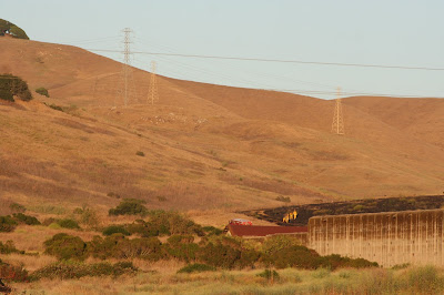
By the end of the summer, usually verdant hillsides were dried and brown and brush fires were a constant threat. The risk struck perilously close to home when a grass fire burned a wide swath across the hill behind our home.
Rainfall averages in our city have been
abysmal over the last few years with the annual precipitation averaging 40% - 50%
of the normal amount we usually receive.
The cumulative deficit has put the majority of the state – including the
part of the state that we live in – in the “extreme drought” category.
 |
| Welcome rain, at a steady rates without flooding. |
Even more problematic than the local
lack of rainfall has been an equally significant decrease in the snow pack in
the Sierra Nevada mountains. Melting of
the mountain snow pack each spring replenishes the aquifers and groundwater supply
that is used during the warmest, driest months of the year to provide water not just for human use but for agriculture as well.
In years of normal rainfall, this pattern
keeps precipitation and water use in balance. But when we don’t get the rainfall and the
mountains especially don’t get their usual winter precipitation, we operate in
a deficit that has been building dramatically for five years.
This year’s el nino will hopefully turn the tide and help us to replenish some of the severe deficit. Already the snow pack is more than twice the average for the entire winter and the season is still young. And here in the North Bay we are seeing optimistic forecasts and substantial enough rain to require umbrellas, raincoats, and for fellow arthritis sufferers, extra ibuprofen. All of this is good.
This year’s el nino will hopefully turn the tide and help us to replenish some of the severe deficit. Already the snow pack is more than twice the average for the entire winter and the season is still young. And here in the North Bay we are seeing optimistic forecasts and substantial enough rain to require umbrellas, raincoats, and for fellow arthritis sufferers, extra ibuprofen. All of this is good.
Here is how things are shaping up. Looking at the actual and average rainfall
for the wet winter months, we will hopefully reach our stride and hit our
annual average by the end of the month. The effect of el nino is definitely. being
felt.
November 2015 1.21 inches
November Average 2.56 inches
December 2015 2.78 inches
December Average 3.79 inches
January 2016 5.78 to date
January Average 4.38 inches
November - January Total 9.77 inches to date
November - January Average 10.73 inches
For today, I’m enjoying a brief
respite from the rain. The sun came out
early this afternoon and although clouds moved in, the sky is clearing again and tomorrow is supposed to be similar weather to
today.... periods of sun and clouds with temperatures about the same, easing into the
60's. Balmy by New England standards and a good day to tend to the roses on the patio. More rain is expected on Thursday evening and
continuing overnight.
The current prediction is for
another 1.5-2 inches or more over the next week and potentially as much as 3-6 total
additional inches before the end of this month. Even more promising (in terms of the drought)
is that the increased rate of precipitation is expected to continue through May
with the mountain snow pack continuing to accumulate and reservoirs also
beginning to refill as well.
One local
reservoir has shown a dramatic improvement in just the past couple of
months.
Folsom Lake lies in the path of the
storms that have been moving through our area and heading east to the mountains
and as a result the water level there is now at 63% of its historical, average
capacity, a dramatic improvement since the water level dropped to a
mind-boggling 14 percent of capacity in November. This reservoir, which is situated about 25
miles northeast of Sacramento has been depleted not just by drought but by
pumping as well into the Sacramento River which was necessary to help maintain the
delicate balance needed for the Chinook salmon to be able to spawn.
References:
Rainfall amounts and averages courtesy of National Oceanic and Atmospheric Administration at www.noaa.gov
Reservoir Capacity Diagram and Map courtesy of http://cdec.water.ca.gov/cdecapp/resapp/getResGraphsMain.action
Folsom Lake: http://www.sacbee.com/news/state/california/water-and-drought/article44927409.html


